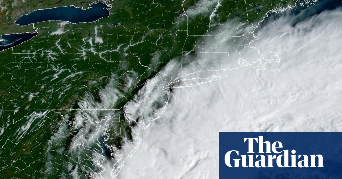
A significant nor’easter is bringing high winds and heavy rain to the US East Coast, potentially impacting up to 40 million people this weekend. The National Weather Service warns of beach erosion, coastal flooding, and power outages from Rhode Island to Maine, with winds expected to reach 40-60 mph and up to 80 mph in Montauk, New York. Up to 8 inches of rain is forecast for parts of southeastern Massachusetts, and 2 inches in Boston and New York City. Travelers should expect flight cancellations and difficult driving conditions.
This storm arrives after weeks of soaking rains, increasing the risk of falling trees and flooding. The Weather Channel notes that while nor’easters are more common in late fall and winter, they can occur earlier in the season. Simultaneously, three hurricanes, Nolo, Odalys, and Polo, are active in the Pacific Ocean, with Nolo posing a threat of catastrophic flooding to Hawaii. This confluence of severe weather events is occurring against the backdrop of a record-setting El Niño, which is amplifying extreme weather globally.
AccuWeather reports the nor’easter has strengthened and will remain close to the shoreline, bringing stronger winds closer to the coast. The Weather Channel advises New York City and Boston to prepare as they would for a tropical storm. While the worst impacts will be felt near the coast, inland areas are also bracing for the storm’s arrival.
Our reading is that the East Coast is facing a confluence of immediate weather threats, a nor’easter and the distant, but potentially severe, impact of Pacific hurricanes, occurring within a larger context of destabilized weather systems. The article highlights not isolated incidents, but a pattern of extreme weather events amplified by a record-setting El Niño and potentially linked to longer-term oceanic shifts. The simultaneous occurrence of these events suggests a heightened level of meteorological volatility.
Read the original coverage
💬 Comments
📜 Comment Policy