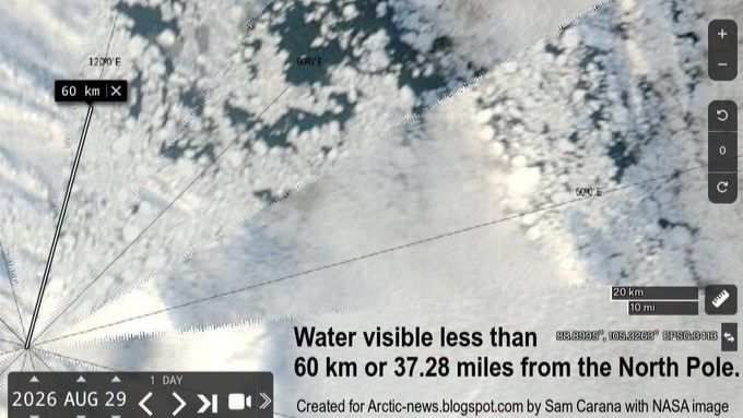
A recent satellite image captured by NASA shows large patches of open water less than 40 miles from the North Pole on August 29. Experts attribute this phenomenon to the increasingly brittle Arctic sea ice caused by global warming.
Julienne Stroeve, a professor of polar observation and modeling at University College London, described the patches as “quite striking,” but noted this isn’t the first time open water has been observed near the North Pole. However, she believes the extent of the open water is unprecedented. In 2016, the central Arctic Ocean and regions north of 80 degrees latitude were also highly fragmented in early September.
Zachary Labe, a climate scientist at Climate Central, explained that the end of summer typically results in more fragmented sea ice and increased open water. Local weather conditions and ocean currents can rapidly change the size of these gaps, with strong winds either compressing or separating ice floes. He observed that satellite images from the last two weeks show dramatic shifts in the amount and location of open water.
While the current extent of Arctic sea ice isn’t exceptionally low compared to record years, Stroeve stated the ice is now more diffuse, making it susceptible to rapid changes. Winds could compress the ice, leading to a sudden decrease in total extent. Labe emphasized that there isn’t a specific distance from the North Pole where open water should normally stop, as Arctic conditions vary annually. However, the summer ice has become thinner and more fragile in recent years, consistently reaching closer to the North Pole than in the past. He clarified that the image represents “a worrying snapshot” of the current situation, rather than evidence of dramatically worsening conditions this year.
Read the original coverage
💬 Comments
📜 Comment Policy